Sunday, February 26, 2023

Doubtlessly Beautiful Doubtful Sound

After one of his long voyages to the South Pacific, Captain Cook's crew craved respite and urged Cook to take shelter in a narrow bay they spied along the South Island's southwest coast.  But Cook declined the request, because he "doubted" the prevailing winds would allow them to sail back out.  Or so the story goes.

Doubtful Sound is a bit further south in Fjordland from the more famous Milford Sound (both labeled as "sounds" on early maps, rather than their true formation, "fjord," but the mistaken identity stuck), which I had been on with my friend Jim in 1981.  Fjordland is known for its rain and its dramatic sea-to-peak landscapes found in only a few other places on earth - Alaska, Norway, and Chile, as far as I know. 

It's a popular tourist destination, so we tried to get a berth on an overnight boat trip a number of months before we left for Aotearoa ... it wasn't easy! We kept checking the online booking system, which showed nothing available for the time interval we would be in the area. Desperate, we made an overseas call (isn't that a quaint term!) and, with a human voice on the other end, were able to reserve the last berth, a family cabin with four bunks and its own bathroom.  Whew!

The trip is actually a 3-part tour: a water taxi across Lake Manapouri to a bus that takes you over 2100 foot Wilmot Pass and down to the fjord, there to board the three-masted "Fjordland Navigator."  We stayed in the little hamlet of Manapouri the night before, enjoying an afternoon swim in the lake.  

At the west end of the lake is a pretty amazing engineering structure.  In the late 1960s, the government decided to build a hydro-electric generating station, but not your normal "dam a river and run its water over turbines."  No, they drilled a vertical 200 meter shaft in the mountain at the lake's west end down which lake water drops and passes through turbines, and then a 10 km tunnel takes the water out to the sea.

The sailing adventure was spectacular, in part because we lucked out with the weather. It was partly sunny and dry when we sailed out the fjord to its mouth and into the open waters of the Tasman Sea. That gave us great views of the various islands and peaks as well as a colony of fur seals.  We were also able to kayak for a few hours in the sheltered bay where the ship anchored for the night. 

But then that night it started rain and did so through the next morning.  Bad news? No!  Because the steep mountain sides are basically rock with a very thin layer of soil and vegetation, the rain doesn't soak in at all, but instead creates hundreds of gushing, sometimes roaring waterfalls.  You can watch videos here and here, and enjoy the photos below: 


Swimming Lake Manapouri

The view looking west as the water taxi took us across the lake

Our first look at Doubtful Sound from Wilmot Pass 

Our 24-hour home

Looking back into the fjord from its mouth, what Captain Cook might have seen

Things were a bit more exciting when we reached the Tasman Sea                                             
F
Just to dramatize the point - we passed this creek on the bus the first day of the tour...


And this is the same creek the next day after the rains ... wow!


Thursday, February 23, 2023

The Inland Beauty of the Southern Alps

Leaving the West Coast, we headed into the heart of the Southern Alps, a land of glacially-fed rivers and alpine lakes. Queenstown is sort of the fulcrum, the jumping off point for famous Milford Sound and the Milford Track, and a base for skiing, fresh water sports, multi-day tramps, etc. 

We'd heard Queenstown was now a busy tourist city - it was a sleepy backpackers haven when I was here 41 years ago - so we opted to navigate our campervan to Wanaka, about an hour's drive away.  

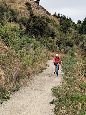
Turned out to be a good choice. Our holiday park was quiet, nicely equipped - it had bicycles to rent, which we did - and well-staffed. The 30km bike ride included a bit of "mountain biking" trail, our first experience with that (no converts here!).  

A highlight of the ride, though, was a colony of Great (Southern) crested grebes. The grebes typically build floating nests; this population has been in decline, so locals built little nesting islands for them, away from potential predators, and the colony has rebounded.

We also had a rigorous hike up to a high point that give us fine views of the town and the surrounding countryside.

We took a side trip to visit an old country inn, the Cardrona Hotel, nestled in the Crown Range that hurtles steeply down to Queenstown. As you see in the photos below, it has a classic "western" look and has been used for that purpose in movies. It was, and still is, a way-station for those traveling between Wanaka and Queenstown, offering rooms, food, and pints.

Enjoy the pics ...


We followed this glacier-fed river for much of the way toward Wanaka.

Panorama of Lake Wanaka on our approach to town.


The communal kitchen at the holiday park.  We had a nice chat with the extended family in the foreground were French, from Guadalupe, New Caledonia, and some island off the coast of Bordeaux. 

Mountain biker Kate!


Great crested grebe on its floating nest. Is there an egg under there?


Awwwwwww!


View from our hike above Wanaka


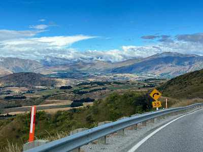
Coming down out of the Crown Range, with Queenstown in the distance

The road down to Queenstown was a series of nasty switchbacks, a challenge for the novice campervan driver!


Monday, February 20, 2023

Beach Birds and Whirlybirds

 Hokitika is a art-friendly community that lies on a long stretch of fine-sand beach, south of Greymouth and north of Fox Glacier on the South Island's West Coast.  We happened to arrive in Hokitika during its beach art festival and spent an afternoon admiring the creativity and sheer enterprise of the "entries":

Giant kiwi!

Ostrich meets its shadow
 
Sea Serpent arrises from the sands

Octopus


Ancient whale skeleton

After Hokitika, on our way south to the town of Fox Glacier, we had some peek-a-boo sightings of 12,000 foot high Aoraki / Mount Cook, the crown jewel of Aotearoa's Southern Alps.  The weather was changing, and we were a little concerned that by time we got to Fox Glacier - named for the 8-mile long (not sure if that's current) glacier that flows from Aoraki - we might not be able to really see much of the mountain range or experience much of the national park. 

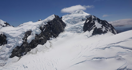
So, when we saw a sign for heli-viewing the peaks and glaciers, we jumped at the chance.  A major splurge! Neither of us had been in a helicopter before, so that, in and of itself, was exciting.  Here's a video and another of some of what we saw and some photos:

Boarding the "bird" ... looks like a toy, doesn't it?!


 Kate sat snuggle-close to the pilot, in the middle front seat, close enough to fly the thing.
 
 
Kate's view

 
 Great views of Mt. Cook
 
The river that flows from Fox Glacier to the Tasman Sea


 There were times it seemed we could almost touch what we were seeing

The Tasman Glacier
Having landed safely ....

More to come.


Tuesday, February 14, 2023

West of South

The West Coast of the South Island is notorious and notable; notorious for the sand flies (no-see-ems) and notable for its wild beauty.  When I was here in 1981, it was also notorious - to hitchhikers - for the paucity of cars.  A car an hour if you were lucky.  We didn't see many hitchhikers, but we did experience the other two attributes ... big time!

We picked up a campervan in Christchurch and headed into the mountains, with our first van-camping experience near Arthur's Pass. (A number of you have some or a lot of experience with this kind of living, but we are neophytes.)

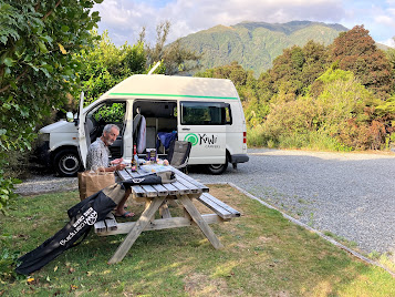
We stayed in so-called holiday parks, privately owned places with communal kitchens, bathrooms, and showers, some even with playgrounds for kids and ping pong tables. Importantly for old travelers of the modern era, they also provided mostly adequate wifi and plug-ins to power our lights and chargers (see the tangle of cords in the photo below!).

At night, we would roll out the double bed and put up shades for a wee bit of privacy.  Despite our trepidations about being in such close quarters, it was kind of fun and, in a way, convenient, having all our cloths and other stuff with us at all times.  No need to worry about whether we forgot to bring a warm sweater or something, wherever we went, we always had all our stuff.  It also had a fridge (which ran off the car battery), so we could buy and have a decent amount of perishables.

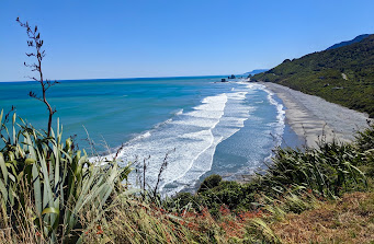
Anyway, after a night at Arthur's Pass, we wound down the west side of the mountains that form the spine of the South Island.  The coastline and coastal highway are beautiful, comparable to US 101 in California and the Great Ocean Road in Victoria, Australia.


Our first destination on the coast was Punikaki or "Pancake Rocks" (no, Punikaki doesn't mean "pancake" in Maori language, it just sounds like it should).  I wanted us to see this place, as it is one of the few vivid memories I have of my previous visit.

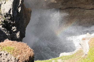
Though very touristy now, the rock formations - limestone layers deposited tens of millions of years ago when this area was deep under the sea - and blow holes are still awesome to see. 


More highlights soon.

Monday, February 13, 2023

We interrupt this Blog ....

 Last night, Cyclone Gabrielle rattled the windows of the 1890s house we're AirBnBing in in Wellington, and still today the rains are lashing the windows and gusts are exceeding 40mph.  One gust shook the whole house.

And we're among the lucky.

Further north, around Auckland and the Coramandal Peninsula, where we have planned to be in about 2 weeks, the cyclone has knocked out power and communications for many and extended the damage the area experienced just two weeks earlier from torrential rains and floods.  Here's a screenshot of a real-time (11am NZ time Tuesday) Google Earth image of Gabrielle sitting off the NE coast of New Zealand's North Island.


We're scheduled to leave Wellington tomorrow, staying overnight in nearby wine country, and then heading up to Napier on the east coast, where a Art Deco festival is scheduled for this week. 

 How the cyclone will affect these plans is at this point unknown.


Monday, February 6, 2023

North of South

 Nelson.  Probably named after some seafaring lord whose first name was Horatio or some such. I haven't googled that one.

We had the good fortune to housesit in Nelson for some Anacortes/pickleball friends' daughter, whose Kiwi family was enjoying fantastic skiing in Utah. So we had this great base to explore the northern edge of the South Island, nine days in one place. And explore we did...

Nelson itself is a nice town, a cute central shopping boulevard, numerous parks and bikeways, an active harbor, at least one good art museum, and probably as many hills as Seattle.  And steep!  Our rented Nissan Tilda struggled to mount the hair-pinned, uphill curves sometimes ... and our abode was at the top of one of those.  Nelson also sits amid one of Aotearoa's many wine regions.

What strikes one upon approaching Nelson from the east is what looks like a very long jetty protecting the waterfront and harbor.  As it turns out, this "Boulder Bank" is a natural formation - a rocky bluff calves boulders into the sea and the currents have, over 10 millenia, continuously pushed those rocks southward to create this long rocky spit.  Only one other exists in the world, somewhere in Japan.

Anyway, Nelson is known in traveler circles for its proximity to Abel Tasman National Park, a popular hiking and trekking destination. When I was in Nelson in 1981, my friend and I chose to do a 5-day trek along the Wangapeka River, over a pass, to the West Coast rather than the AB, so I was eager this time for us to experience Abel Tasman.

We had a wonderfully relaxing time in Nelson, enjoyed getting to know the town and environs a bit, and even had our first Kiwi pickleball game at the badminton pavilion in nearby Richmond.

In the pictures below, you'll see visual evidence of our Nelson adventures:

* 32km bike ride from Nelson to Mapua, almost entirely on separated bikeways but also totally exposed to New Zealand's powerful UVs.

* The Nelson stop on the international buskers festival - a short video of a showman from Belfast.

* Water taxi along the coast of Abel Tasman NP, where we were dropped off at Torrent Bay, hiked to Bark Bay, and picked up again by the water taxi.

* 3-hour kayaking tour of Golden Bay, off the NW edge of Abel Tasman NP. 


Some of the hills of Nelson

Sunset from "our" ridge in Nelson

Walking the Boulder Bank

Torrent Bay, where we started our Abel Tasman hike


Swing bridge on the way to Bark Bay, Able Tasman


Hidden cove on Abel Tasman NP's coast

Waiting for the water taxi after our Abel Tasman hike


Nelson had a very cool classic car museum

Another swing bridge, this one on our 32km bike ride


The bike ride skirted an estuary that drained at low tide, revealing colorful grasses and lots of shore birds

At the end of the bike ride, in Mapua, we found this artist who made amazing figures out of found metal


Some very cool rock formations during our Golden Bay kayak, which took us into Wainui Bay and its huge green-lipped mussel farm

Spotted shags eyed us as we paddled by


“The Center of New Zealand” - Nelson claims it is the geographic center of Aotearoa, which monument we reached after a short, steep climb.


Another Detour ....

   ... but this one was planned. We took the opportunity of being in the same hemisphere as Australia to carve out a two-week visit to the p...